Feature: China increases footprint of special-mission ships
In recent years, Chinese ships with seemingly dual-use applications have become an increasingly prominent feature of the Asia-Pacific maritime landscape.
Some of these vessels, such as civilian-manned missile-tracking ships, are more overt in the way they support People’s Liberation Army (PLA) operations.
Others sail under the banners of universities, scientific institutes, or deep-sea research organisations, yet possess capabilities that could generate valuable intelligence for the PLA Navy (PLAN).
The increasing scale and geographic reach of these vessels’ activity make it difficult to treat each appearance across the region as an isolated incident.
An emerging pattern suggests that China is deploying these vessels to collect data that could support Chinese naval planning.
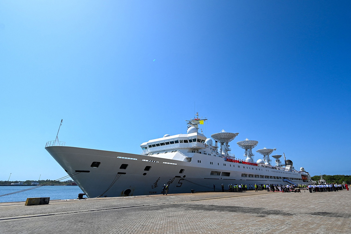 China's research and survey vessel, Yuan Wang 5, seen here at Hambantota in August 2022. Image credit: Ishara S Kodikara/AFP via Getty Images
Space and telemetry
The most overtly strategic vessels in this group are the Yuan Wang-series of missile and spacecraft tracking ships.
Although sometimes described by Chinese state media reports as research or survey vessels, the ships’ principal function is to extend China’s land-based tracking network into the oceans and provide telemetry, tracking, and command support for space launches and long-range missile tests.
The class of ships can be distinguished by its large parabolic antennas, radar installations, and telemetry receivers.
These sensors allow the ships to observe rockets, spacecraft, and ballistic objects beyond the coverage of tracking stations on Chinese territory and collect data on trajectories, propulsion performance, and associated electromagnetic emissions.
This data collection applies not just to Chinese launches but also to foreign missile trials.
One of the more prominent vessels in this fleet is Yuan Wang 5, which was commissioned in 2007.
The 25,000-tonne tracking ship is equipped with several large dish antennas and associated radar and telemetry systems.
Yuan Wang 5 attracted particular attention when it called at Sri Lanka’s Hambantota port in August 2022. India raised concerns over the visit because the ship’s tracking equipment might be used to observe Indian activities. Colombo eventually permitted the port call on the condition that the vessel did not conduct research in Sri Lankan waters.
Yuan Wang 5 subsequently returned to the Indian Ocean in September 2025 as India issued a notice to airmen (NOTAM) restricting an area of the Bay of Bengal for a prospective long-range weapon trial.
The vessel’s presence did not by itself prove that it was monitoring the test, but its known capabilities and the timing of its deployment drew Indian scrutiny.
Its sister ships Yuan Wang 6 and Yuan Wang 7 have also generated similar concerns during operations in the Indian Ocean Region between 2022 and 2026.
For the PLAN and China’s wider strategic establishment, the value of the Yuan Wang class fleet extends beyond individual missile tests.
By positioning ships along expected flight paths, China can obtain observations that would otherwise require overseas ground stations or space-based sensors.
For China’s military planners, measurements of foreign missile behaviour could support threat modelling, ballistic missile defence development, electronic-intelligence libraries, and assessments of an adversary’s nuclear or conventional strike capabilities.
Strategic hydrography
The Xiang Yang Hong-series of oceanographic vessels occupy a more ambiguous part of the spectrum.
They are generally presented as research ships, but several have operated in strategically significant areas.
One of these vessels, Xiang Yang Hong 06, carried out persistent survey-like activity near strategically important submarine cables in the Pacific Ocean.
Automatic Identification System (AIS) data show that, between February 2024 and May 2024, the vessel completed three survey operations east of Guam near the Apricot and Asia-America Gateway cable systems.
During these operations, the ship followed the parallel-line, or ‘lawnmower’, patterns associated with systematic bathymetric surveying.
Such activity can create detailed maps of seabed contours, sediment types, and possible hazards.
It can also identify the approximate location and environmental setting of undersea cables, although proximity to a cable does not establish that the ship inspected or interfered with it.
For China’s naval planners, the cumulative product of surveys like the one carried out by Xiang Yang Hong 06 can be incorporated into submarine navigation systems and operational planning.
Repeated access also enables China to measure seasonal changes and determine how monsoons, currents, and temperature layers affect acoustic conditions across waters such as the Indian and Pacific oceans.
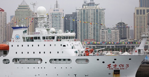
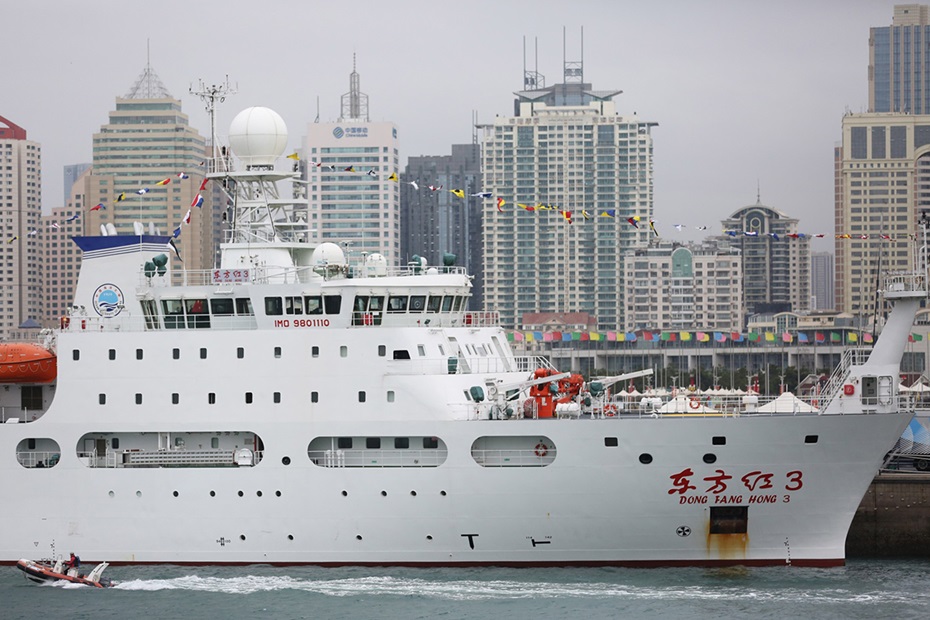
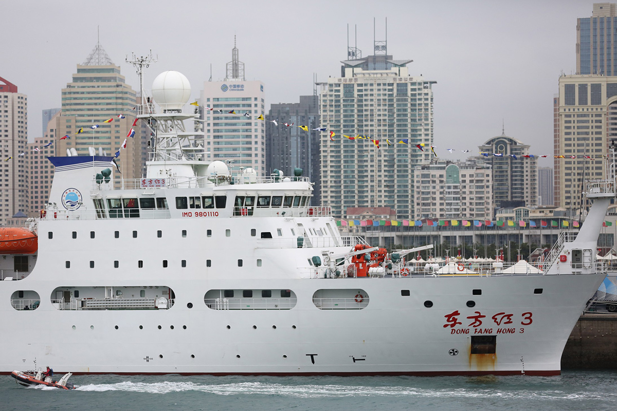 Dong Fang Hong 3 seen here on display during a ceremony at Qingdao Olympic Sailing Centre on 25 October 2019. Image credit: Photo by Zhang Jingang/VCG via Getty Images
Undersea picture
While the Xiang Yang Hong series of vessels have been deployed to gather data that can improve subsea operations, China has commissioned another vessel, Dong Fang Hong 3, which has demonstrated a capacity for arguably more sophisticated military applications.
The vessel’s ultra-silent signature allows it to gather highly precise hydroacoustic and bathymetric data, map deep-sea terrain, and test underwater tracking technologies that directly enhance antisubmarine warfare and subsurface naval capabilities.
Delivered in 2019, the ship is approximately 103.8 m long and 18 m wide, with a gross tonnage of about 5,602.
It was built to the DNV GL SILENT-R standard, a stringent classification for limiting underwater-radiated noise.
The reduced acoustic signature improves the performance of sensitive hydrophones and other instruments by minimising interference from the ship itself.
Dong Fang Hong 3 has conducted operations in waters as deep as 10,000 m and has deployed and recovered a 10,000 m-rated underwater glider.
In 2024 and 2025, the vessel was deployed in around Taiwan, near Guam, in waters close to Japan and across parts of the Indian Ocean.
More notably, in March 2025 the vessel conducted repeated tracks between Sri Lanka and Indonesia, covering approaches to the Malacca Strait, which suggests that China is mapping the critical waterway’s underwater terrain.
Dong Fang Hong 3’s low-noise design is particularly relevant when carrying out operations in busy and relatively noisier waters such as the straits of Malacca and Singapore. A quiet research ship can collect cleaner acoustic data.
For the PLAN, the resulting data could improve the reliability of passive acoustic surveillance, help establish baseline sound conditions in noisier waterways and support the detection or classification of submarines in the region.
Data from such cruises can also support preparations for deployments. Before submarines deploy into an area, commanders require accurate bathymetry, seabed-hazard information, knowledge of merchant-shipping noise, and predictions of sonar conditions.
A university-owned vessel can collect this information during peacetime without the political visibility associated with deploying a PLAN hydrographic ship.
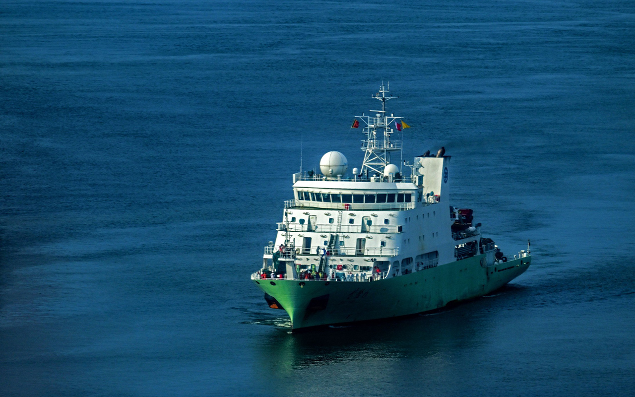 Shi Yan 6 seen here arriving near a port in Colombo on 25 October 2023. Image credit: Ishara S Kodikara/AFP via Getty Images
Bluewater research
The Shi Yan 6, translated as Experiment 6, represents a further enhancement of China’s deep-sea exploration capability.
It is officially classified as a civilian oceanographic research vessel. It entered service in late-2020 or early-2021 and undertook its maiden research voyage in September 2021.
The vessel is operated by the South China Sea Institute of Oceanology, part of the state-run Chinese Academy of Sciences (CAS).
Shi Yan 6 was designed to bolster China's bluewater research capabilities, allowing scientists to venture far beyond Beijing’s sea lines of communication (SLOCs) into the broader Indo-Pacific region to study complex marine geophysics and ocean chemistry.
From a structural and performance standpoint, Shi Yan 6 was engineered for prolonged operations in demanding open-ocean environments.
It has an overall length of 90.6 m, a moulded beam of 17 m, a depth of 8 m, and a gross tonnage of nearly 4,000.
Powered by diesel-electric propulsion systems, it is capable of reaching a maximum speed of 16.5 kt and a range of about 12,000 n miles (22,224 km) at cruising speed.
Shi Yan 6 can sustain a crew and scientific contingent of up to 60 personnel for 60 consecutive days at sea without replenishment. It features a broad working deck exceeding 600 m2, providing space to deploy heavy maritime instrumentation and handling complex towing arrays.
According to Chinese academic literature, the vessel is outfitted with an array of multibeam echo sounders, sub-bottom profilers, and deep-sea seismic acquisition systems that allow it to map the ocean floor and the geological structures beneath it. However, no further details of these systems have been revealed.
The ship is also, according to the literature, equipped with dry and wet laboratories with automated sensor networks that continuously sample water quality, salinity, temperature, and atmospheric conditions at the sea-air interface.
It has also been fitted with high-speed satellite data transmission arrays, enabling hydrographic data gathered while under way to be transmitted in real time to mainland research facilities for immediate processing and analysis.
While its stated role is civilian exploration, the data Shi Yan 6 collects could have strategic utility for the PLAN.
By using its multibeam sonar arrays, the ship can generate high-resolution, three-dimensional bathymetric maps of the seabed.
For the PLAN, this detailed charting is foundational for underwater navigation, allowing Chinese attack and ballistic missile submarines to traverse critical geopolitical chokepoints in complete darkness without using active sensors that would compromise their position.
Continuous environmental profiling also allows the PLAN to map out shifting thermoclines and salinity gradients across various parts of the Asia-Pacific region.
Naval forces use these acoustic models to predict sound propagation windows, letting commanders hide their own submarines inside acoustic blind spots or tune surface fleet listening arrays to detect adversarial submarines.
The apparent application of this dual-use surveillance is strengthened by AIS data, which indicates the presence of persistent and high-frequency tracks across various parts of the Indian Ocean Region.
Shi Yan 6’s presence in these waters triggered diplomatic tensions in October 2023 when it made a port of call at Colombo Port in Sri Lanka.
India raised strong objections to the port call, arguing that Shi Yan 6’s geophysical surveys in the Indian Ocean Region could map critical submarine paths and gather data to counter Indian naval operations.
Washington backed India's stance. Then-US Under Secretary of State Victoria Nuland and then-US Ambassador to Sri Lanka Julie Chung met directly with Sri Lankan leadership to warn against providing logistical support to Shi Yan 6, citing the dangers of Chinese surveillance networks.
The vessel was eventually allowed to dock in Sri Lanka for bunkering and replenishment of victuals.
But despite the diplomatic protests, the vessel expanded its geographic footprint deeper into the subcontinental backyard in the years following the docking at Colombo Port.
The ship executed a four-month survey mission between November 2025 and February 2026, mapping various strategic corridors across the Indian Ocean Region during this period.
AIS tracking data revealed the ship operating extensively near the Ninety East Ridge before moving to waters around the Maldives and transiting the Bay of Bengal.
The ridge sits alongside a region with complex underwater topography that features deep trenches, ridges, and varied thermal layers.
This environment allows submarines to mask their acoustic signatures, hiding from surface sonar.
By mapping this ridge, a navy can identify deep-water navigation pathways, allowing their submarines to transit undetected from the South China Sea into the deep waters of the Indian Ocean.
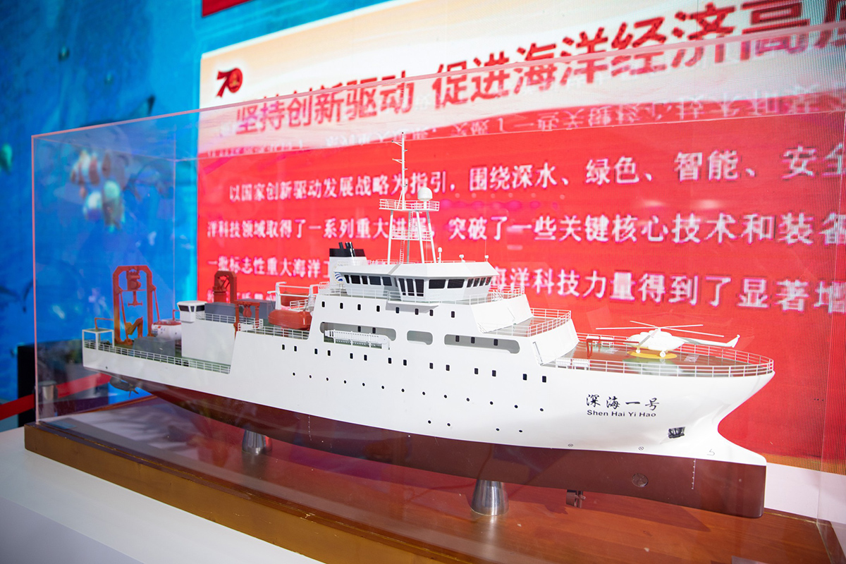 A model of Shen Hai Yi Hao on display during the 2019 China Marine Economy Expo at Shenzhen Convention and Exhibition Centre. Image credit: Huo Jianbin/Southern Metropolis Daily/VCG via Getty Images
Jiaolong submersible
While Shi Yan 6 has been built to undertake lengthy missions and map underwater topography in high resolution, it is not able to collect samples nor manipulate objects that lie at the bottom of the ocean.
Understanding the exact density, composition, and shear strength of seabed soil is critical for planting heavy underwater military infrastructure.
This data dictates where the military can securely place hydrophone listening grids, or anchors for anti-submarine mines.
These are capabilities that China likely sees are critical in Beijing’s effort to secure its SLOCs.
In a likely pursuit of this objective, China built the Shen Hai Yi Hao, or Deep Sea No. 1, which undertakes the role as the support ship for the country’s Jiaolong crewed submersible.
Built in 2019, Shen Hai Yi Hao is approximately 90.2 m long and 17 m wide, with a displacement of about 4,700 tonnes and deadweight of around 1,704 tonnes.
Meanwhile, the Jiaolong submersible is an 8.2 m titanium-hulled vessel that displaces between 22 tonnes and 25 tonnes depending on its payload, and it can accommodate a crew of three.
Jiaolong is capable of descending beyond 7,000 m, giving the ship-submersible combination access to most of the global ocean floor.
Working in tandem with this submersible, Shen Hai Yi Hao can support deep-sea sampling, topographic mapping and extended submersible operations.
The vessel entered the Indian Ocean in November 2025 and was reported heading towards the Maldives while other Chinese research ships were operating in the region.
Its deployment coincided with that carried out by Shi Yan 6, though there is no conclusive public evidence to show that the vessels collaborated on joint missions throughout the period.
In October 2026, AIS data placed Shen Hai Yi Hao in waters north of Australia after leaving Xiamen on 24 September 2026.
Such distant operations underline the vessel’s capacity to sustain deep-sea missions across the Western Pacific and eastern Indian Ocean.
For more information, please see Feature: China increases footprint of special-mission ships