Janes - News page
New GEOINT fusion analysis tool could play role in ABMS, JADC2 systems
30 October 2020
by Carlo Munoz
New geospatial intelligence (GEOINT) fusion analysis software, designed to leverage artificial intelligence (AI) and machine learning (ML) technologies in the management of multisourced big data streams, could find a role in a pair of the US armed forces’ premiere multidomain command-and-control initiative.
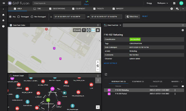
The new GPX Fusion software developed by BAE Systems is squarely focused on helping GEOINT analysts navigate the ever-increasing stream of raw data gathered by intelligence, surveillance, and reconnaissance (ISR) satellites operating at geosynchronous orbit.
Under development for the last two and-a-half years, GPX Fusion “is really centred around how ... to solve some of our customer’s big data challenges” by enabling end users to “essentially consume and visualise” not just GEOINT data but also non-imagery based intelligence data not previously possible, said Damon Brady, senior director of product development at BAE Systems’ Advanced GEOINT Systems.
New geospatial intelligence (GEOINT) fusion analysis software, designed to leverage artificial intel...
New GEOINT fusion analysis tool could play role in ABMS, JADC2 systems
30 October 2020
by Carlo Munoz
New geospatial intelligence (GEOINT) fusion analysis software, designed to leverage artificial intelligence (AI) and machine learning (ML) technologies in the management of multisourced big data streams, could find a role in a pair of the US armed forces’ premiere multidomain command-and-control initiative.
The new GPX Fusion software developed by BAE Systems is squarely focused on helping GEOINT analysts navigate the ever-increasing stream of raw data gathered by intelligence, surveillance, and reconnaissance (ISR) satellites operating at geosynchronous orbit.
Under development for the last two and-a-half years, GPX Fusion “is really centred around how ... to solve some of our customer’s big data challenges” by enabling end users to “essentially consume and visualise” not just GEOINT data but also non-imagery based intelligence data not previously possible, said Damon Brady, senior director of product development at BAE Systems’ Advanced GEOINT Systems.
New geospatial intelligence (GEOINT) fusion analysis software, designed to leverage artificial intel...